
The map of South Africa as it is today came through a very long journey. In much earlier times, the country had no map as there was no single country called South Africa. The maps that existed then were for the kingdoms that occupied the area.
South Africa as it is today used to be various isolated kingdoms. These kingdoms were all independent, with kings and people who had different cultures from others. Though these kingdoms were small, they had survived a long history before they were cooked into a single pot called South Africa.
Map of South Africa Today
-

Map of South Africa
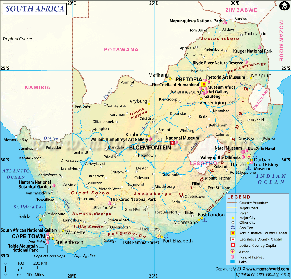
South African Map captures the lands that make up the country. South Africa sleeps at the tip of Southern African sub-region. With a population of over 53 million, it is one of the most populated countries in Africa.
The map of the country indicates where the three capitals of Pretoria, Cape Town, and Bloemfontein are located. The map also shows the location of the nine provinces of the country and its major towns and cities, including Johannesburg and Durban. Others include Port Elizabeth, Rustenburg, and East London among others.
More so, the map shows the 2,798 Kilometer coastline of the country on the Atlantic and Indian Oceans. It shows where the two oceans meet. A well-detailed map of the country will show other major places in the country such as parks, roads, waters, and stadium.
On the map of South Africa, one can see Lesotho. Although a sovereign country of its own, Lesotho is seen on the South African map as it is surrounded by South Africa. The country sleeps between the provinces of Free State, Eastern Cape, and KwaZulu-Natal. It is the hole on the South African Map.
Apart from Lesotho, a large chunk of Swaziland can be seen curved into the South African map. The country is between Mpumalanga and KwaZulu-Natal.
Historical Overview
Most people begin the history of South Africa with Bartholomew Dias whom “they” say discovered the area that later became South Africa. It has been claimed that this Portuguese navigator found the region as he searched for open doors to India for trade.
Before Dias came, there was life in the region. In fact, if we are to go with the archaeological evidence, people have occupied South Africa for more than hundred thousand years.
Also, there were stories of migration associated with the country such as that of the Bantu people who had moved from the Niger Delta River in Sub-Saharan Africa about 2,500 years ago to South Africa. Before the Bantu people were the San people and the Khoikhoi.
Read Also: South African Capitals – Here’s What You Need To Know
The first western settlement in the region, however, occurred in 1652. From this period, until 1806, there have been various battles for the soul of the area, between the Dutch, French, and British. It was the British however, that later had the day.
-

Zulu Warriors
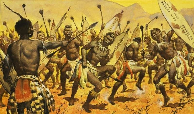
Among the various Kingdoms that were in this area was the Zulu Kingdom, which covered an area of 30, 000 km2. On the South African Map, the Zulu Kingdom occupied the area today known as KwaZulu-Natal. The Zulu battled the British under the leadership of Shaka Zulu. Although it won some of the battles, it was later conquered.
By 1910, the British had 4 colonies in the region. In that year, they united the colonies. These colonies are Cape Colony, Natal Colony, Transvaal Colony, and Orange River Colony.
Geographical Map of South Africa
South Africa shares borders with some Southern African countries. These countries are Namibia, Zimbabwe, Botswana, and Mozambique. South Africa is a medium size country, with a land area of over 1.2 million square kilometers.
South Africa has an interesting topography made of plateaus, mountains, plain lands, escarpment, and coastlines, which are as well captured on the map. The central plateau in South Africa is highest in the east and slopes gently as it moves west. For mountains, the Cape region is more prominent as a result of the Cape Fold Mountains. The coastline of the country is indented as a result of flooding of the sea.
Before 1994, the map of South Africa captured only four provinces as they were the only ones existing. These provinces were Cape Province, Orange Free State, Transvaal, and Natal. Of the provinces, although crowded, Gauteng is the smallest in size, while Northern cape, with over 30% of the land is the largest.
After 1994, the map had a different internal shape. It was adjusted to capture the newly added and reconstructed Provinces, making the map as it is today.